Stand In The Door 1944
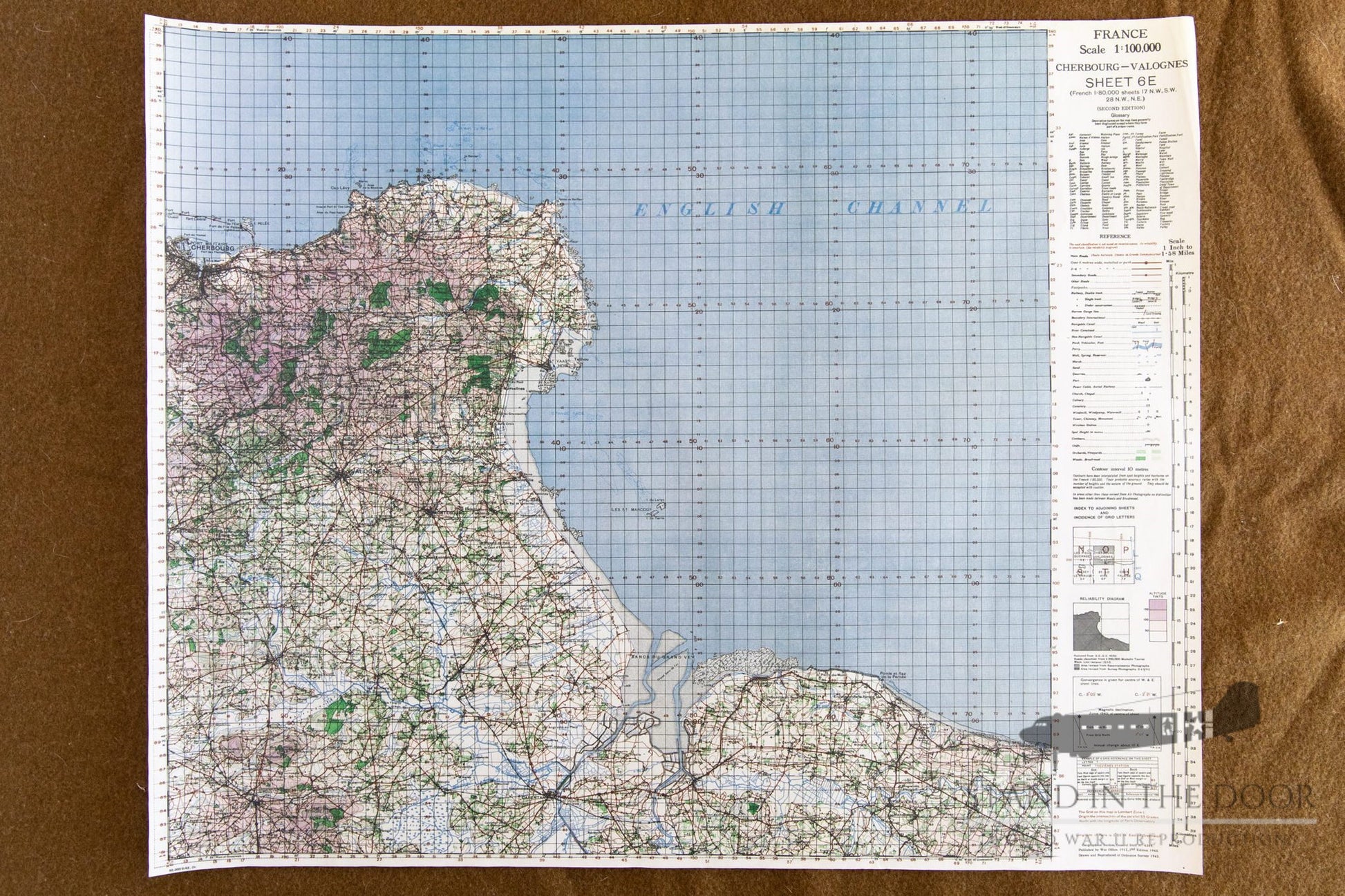
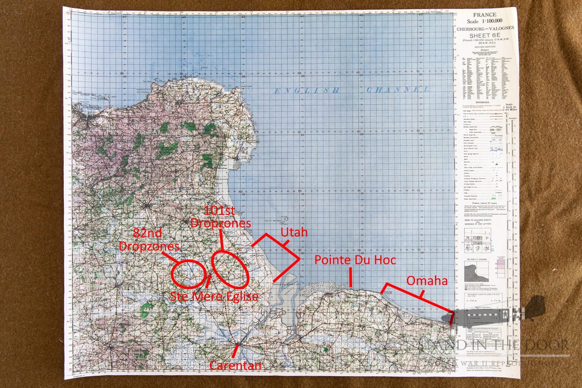
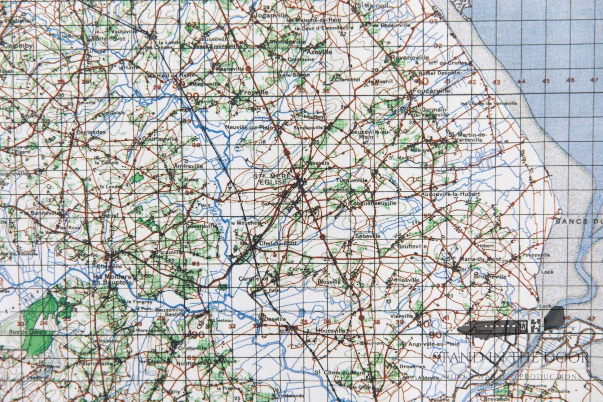
Normandy Map 50- Cherbourg
Normandy Map 50- Cherbourg
Couldn't load pickup availability
These reproductions are made from scans of the original maps and maintain the same size, color, and scale of the originals. The grid squares maintain their original size and can be used accurately with modern or vintage protractor tools. They have been color printed on one side of 20LB bond engineer paper leaving the back of the map white.
Whether folded and creased to fit in a pocket or map case for field use kept flat to be framed for static display these maps will make great additions to any collection.
These maps will be folded several times and shipped in a cardboard envelopes along with any other items in the order. Please note, that like all paper items, these maps may have small folds or imperfections, these are to be expected and are not considered "damaged" and are not eligible for returns.


