
Stand In The Door 1944
Normandy Map 2- Carentan
Normandy Map 2- Carentan
Couldn't load pickup availability
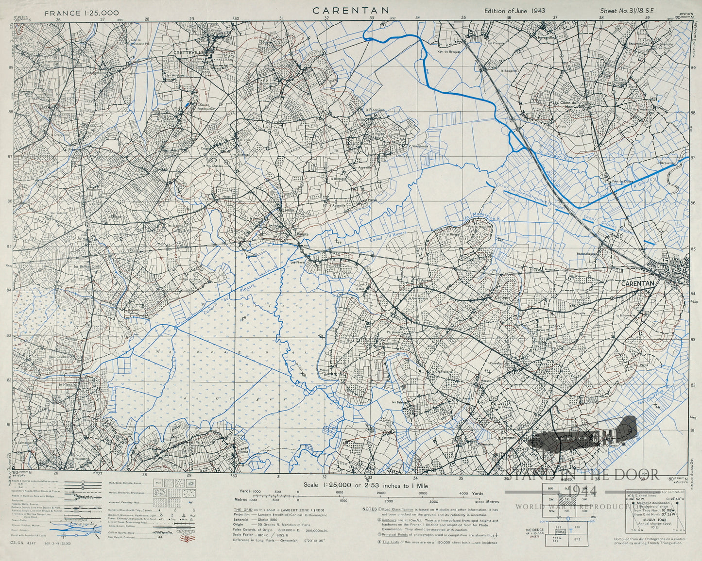
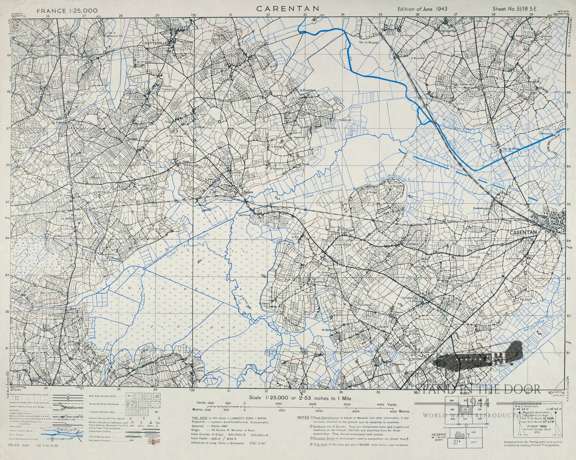
Reproduction "Carentan" map in 1:25,000 scale. This scale map was most commonly used by platoon leaders, company commanders, and senior platoon/company NCO's in Normandy for use in land navigation and tactical movements.
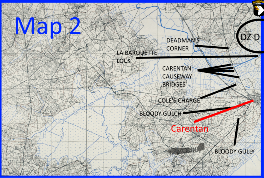
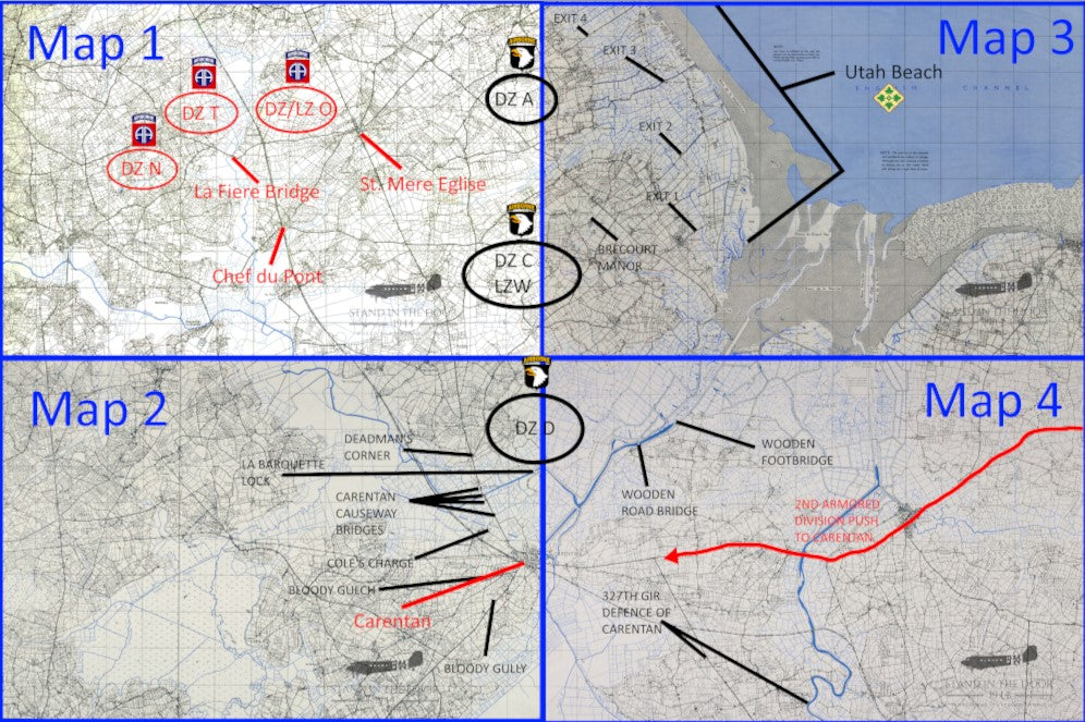
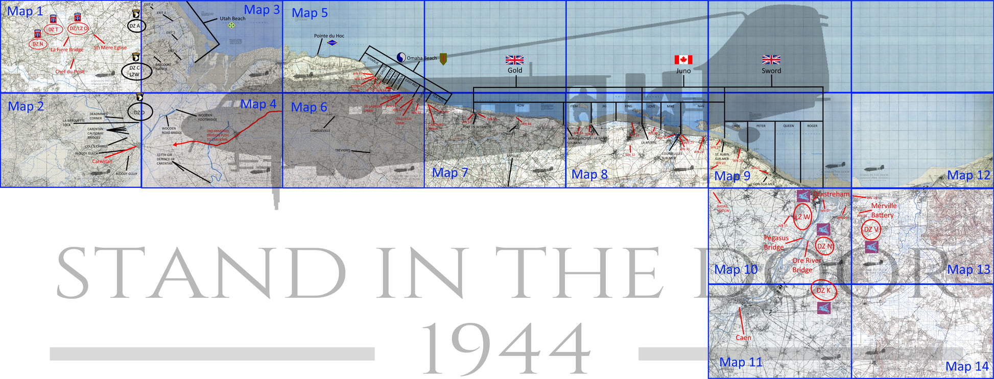
NOTE: The "labels" featuring D-Day objectives and drop zones (on the second picture in this listing) are for reference only and are not on the printed map you will receive.
This map primarily shows the city of Carentan as well as the surrounding areas to the north and west including Dead Man's Corner, St Come du Monte, and the Carentan Causeway later nicknamed "Purpleheart Lane" by the men of the 502nd Parachute Infantry Regiment. Also featured on this map are the areas known as "Bloody Gulch" and "Bloody Gulley" where the 101st Airborne and 2nd Armored Division fought off the 17th SS Panzergrenadier Division and the remainder of the 6th Fallschirmjager Regiment.
Keep in mind that geographic maps used in World War Two were not being made in relation to the tactical environment of the battlefield. Most if not all cartographers (map makers) did not know where the D-Day invasion (or any other invasion) was going to take place so you often find that key objectives are split over several different maps. That being the case officers and NCO's often carried numerous maps not knowing if their tactical movement would keep them on one map or take them across several maps.
These reproductions are made from scans of the original maps and maintain the same size, color, and scale of the originals. The grid squares maintain their original size and can be used accurately with modern or vintage protractor tools. They have been color printed on one side of 20LB engineering paper leaving the back of the map white.
Whether folded and creased to fit in a pocket or map case for field use or kept flat to be framed for static display these maps will make great additions to any collection.
These maps will be folded several times and shipped in a cardboard envelopes along with any other items in the order. Please note, that like all paper items, these maps may have small folds or imperfections, these are to be expected and are not considered "damaged" and are not eligible for returns.