
Stand In The Door 1944
"Silk" Escape Map- Italy/Sicily
"Silk" Escape Map- Italy/Sicily
Couldn't load pickup availability
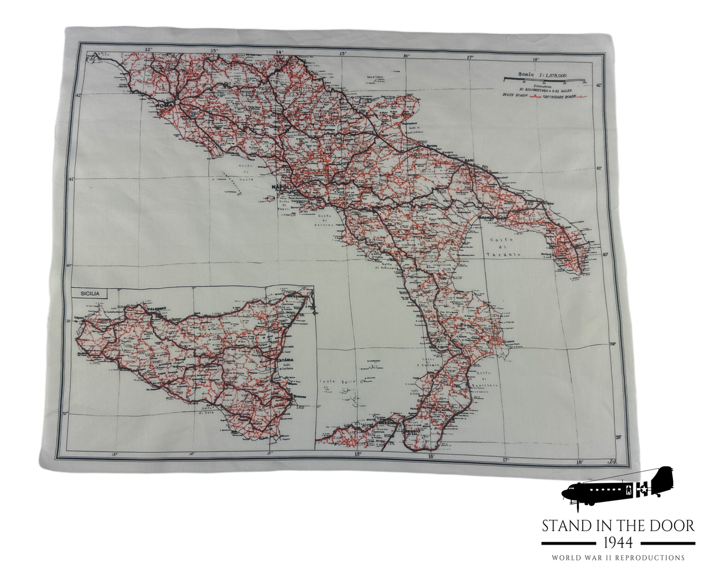
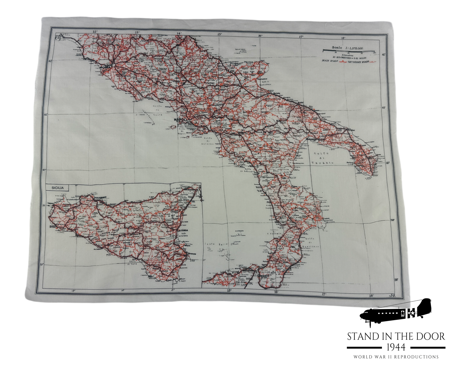
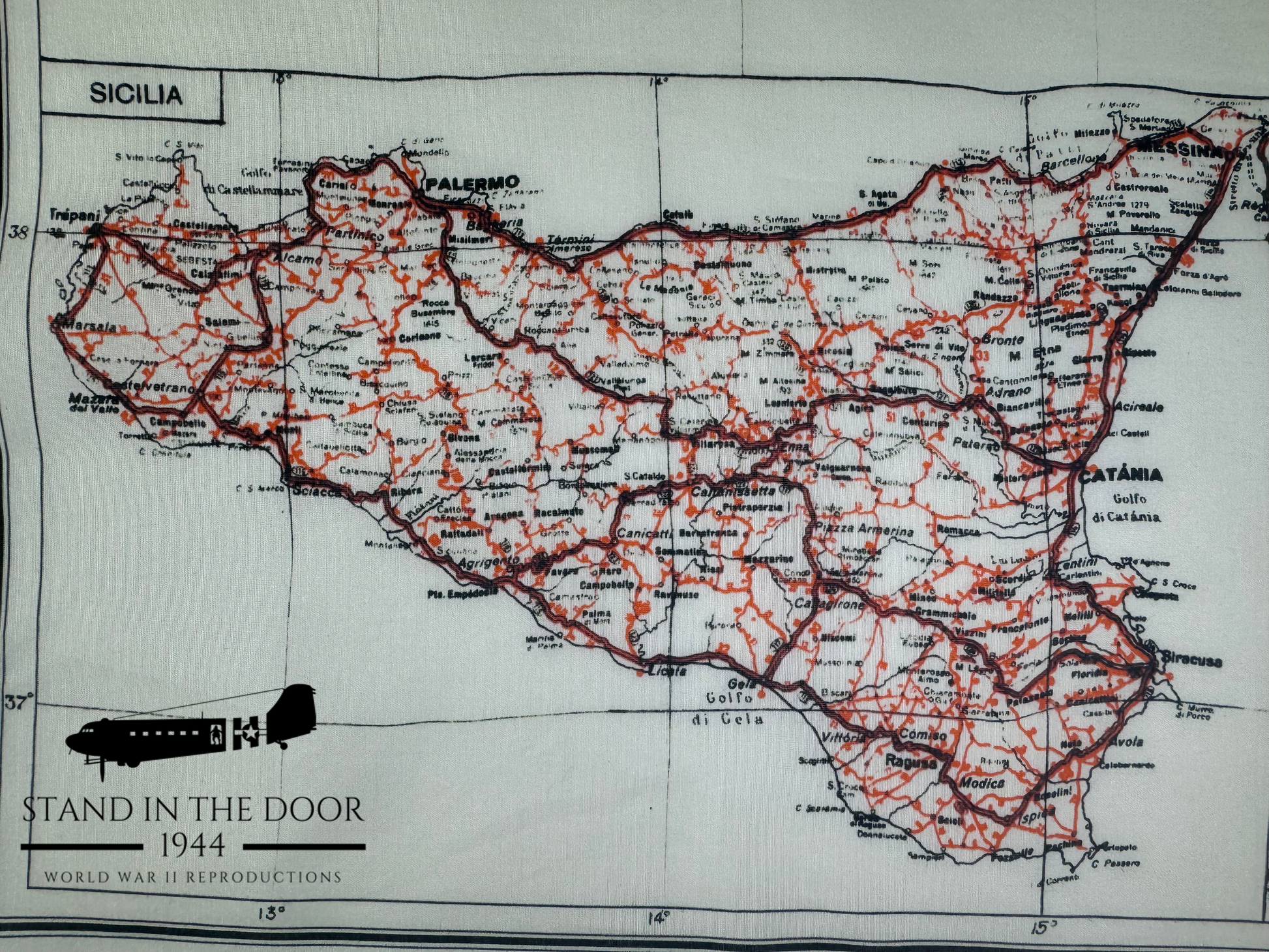
These are museum quality reproductions of the highly sought after WW2 Italy/Sicily escape/evasion map issued to paratroopers and aircrews flying missions in the Mediterranean Theater during WW2. These maps were issued in escape kits along with a small compass and hacksaw blade (see my other listings) that service men could use in escape and evasion senecios.
We have used the same manufacturing techniques used to make our very popular Zones of France escape maps to create one (if not thee) best reproduction ever made of this highly sought after cloth map. Created using the details of an original our reproduction holds the characteristics of size (approximately 15.5"x20"), color, shape, and feel. Printed on a cotton/silk blend fabric, it perfectly matches the weight, feel, texture, and opacity of an original. The only adjustment we had to make was to only print one side of the original map.
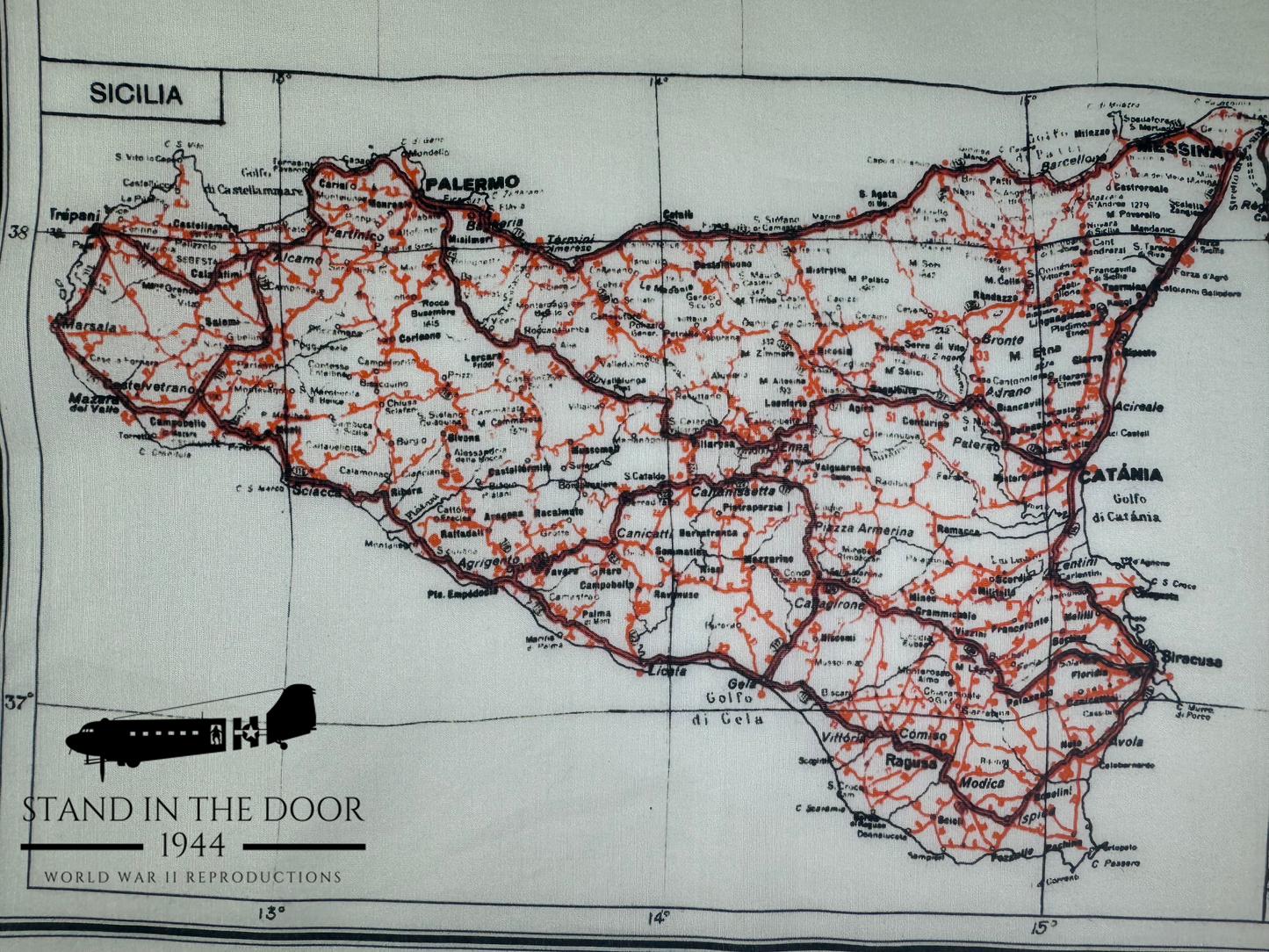
An original Sicily/Italy escape map was printed on both sides with one side showing Sicily and the lower portion of the Italian peninsula and the other side showing the northern area of the peninsula where Italy meets the mainland of Europe. We did not want to risk the colors of one side bleeding into the other so we decided to only print the primary side of the map.
These reproductions are great display piece for your office or they can be used to make your WWII impression even more accurate while at the same time being a fraction of the cost of an original map.
HISTORICAL CONTEXT:
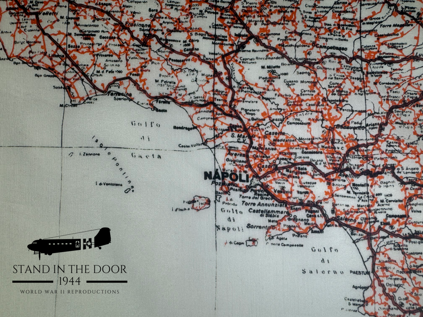
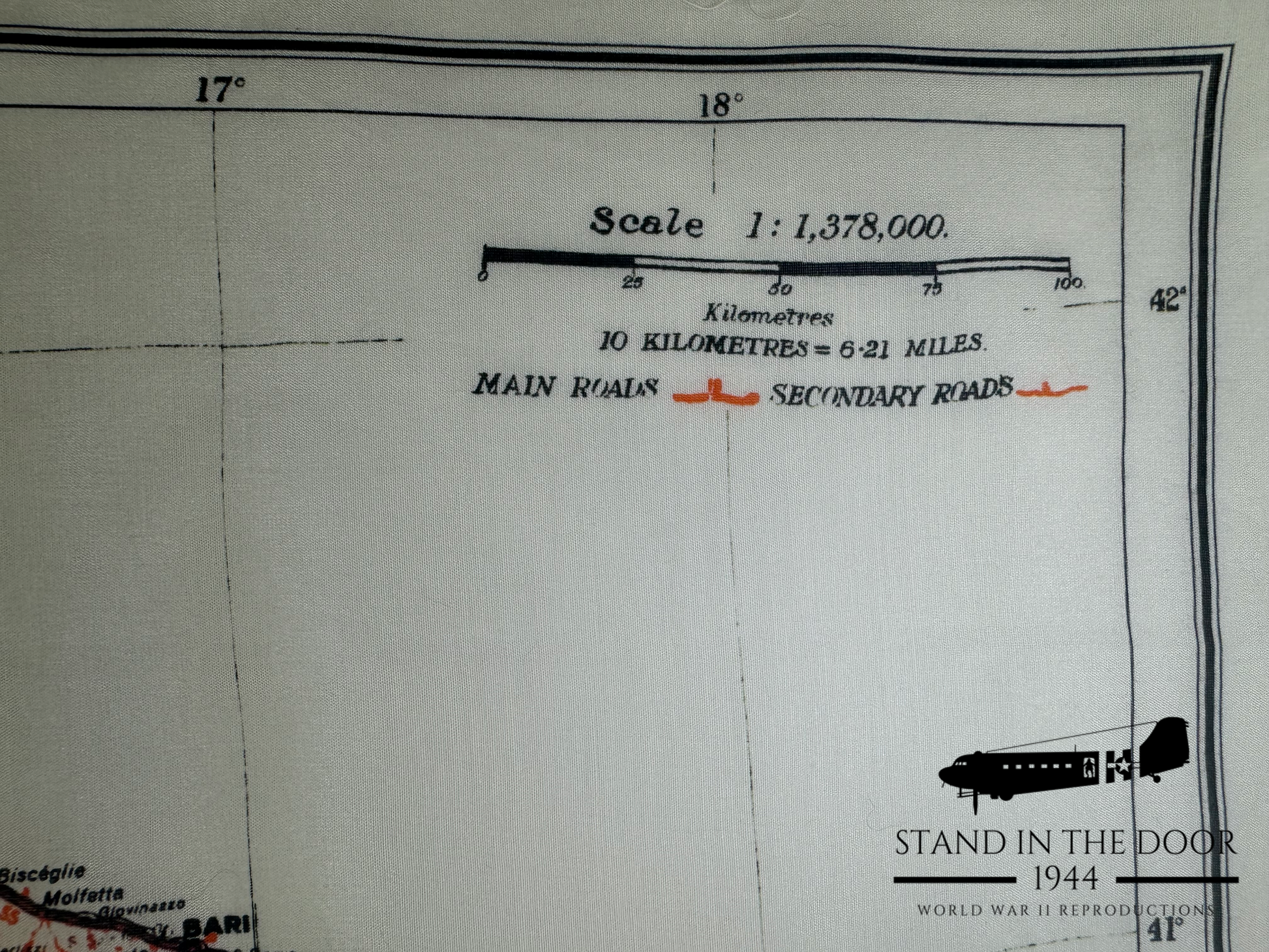
The Italy/Sicily map was designed as an "escape map" meaning that it was printed on a rather small bit of fabric which could be hidden easily on the body when captured as well as it was printed in an exceptionally large 1:1,378,000 scale. That being the case the map was not very useful for traditional military land navigation. There are no gridlines that can be scaled with a protractor and much of the smaller print is difficult if not impossible to read even under a magnifying glass due to its large scale as well being printed on the porous surface of fabric instead of the smooth surface of paper. Rather it was used primarily to determine a person's general geographic location so they could plan a route to "neutral" counties like Switzerland and Spain and be smuggled back to England.
DIMENSIONS:
Each map is approximately 15.5"x20". The outer dimensions of the boarder will vary from map to map. If you wish to make the map boarder uniform all the way around you can do so with scissors or a rotary fabric razor and a straight edge very easily.
MATERIALS:
These reproductions have an "unfinished" edge just like originals which means that the edges can fray with use. (Note: If you would like to prevent the edges of your map from fraying simply fold the edges and sew them down or you can use an iron on adhesive)
LEDGIBILITY: While the main towns and cities of this map are clearly legible the smaller fonts on this map can be very difficult to read. This same characteristic can be seen on original maps as well. When printing fine text with ink on a porous fabric service the letters will not be as legible as they are on a paper map. This is not a product defect but one that is copied from originals.
INTERNATIONAL BUYERS:
Special note for international buyers (buyers outside the US): international shipping costs cover the postage for the order but maybe subject to customs fees unique to your country. Seller is not responsible for any additional postage or customs fees.
SPECIAL NOTE:
Special note to those who own original Italy/Sicily maps. This reproduction may not match your specific original map perfectly. A brief internet search will show you that there were many different manufactures of these maps all using different looms, printers, and materials. If you would like further detailed pictures prior to ordering, don't hesitate to message me.
.